Walking The West Highland Way In 5 Days

West Highland Way is one of Scotland’s most popular long-distance trails so it wasn’t a difficult decision to pick this as my first long-distance trek. The way runs 154km/96 miles from Milngavie to Fort William with a total ascent 12,143ft. It really is one of the most physically and mentally demanding challenges I’ve done so far!! Words cannot describe how breathtakingly astonishing the Scottish Highlands is!! I was expecting typical Scottish weather but got lucky with 4 good days out of the 5!!

I’ve wanting to hike the West Highland Way for many years so doing in in 5 days made it an even bigger accomplishment!! On average, most hikers take 6 to 8 days to complete the trek. I worked out to hike the West Highland Way in 5 days rather than the usual 7. It takes on average an extra 2 to 3 hrs per day on top of the estimated Walk Highlands times. Although it actually turned out more like hiking 10 hours a day.
Being outdoors is naturally therapeutic and getting close to nature has many health benefits. Breathing in plenty of fresh air is really good for the soul and the energetic workout improves your fitness. This enormously improves mental health so you’ll sleep, eat and feel better. There’s a sense of adventure when venturing into the great outdoors and there’s an opportunity to take some decent photography.
The baggage transfer service allows you to carry a light day pack which made it possible for me to do it in 5 days. Every day I reached the campsite/bunkhouse, my suitcase would magically appear. The suitcase weighed about 20kg and included camping gear, spare waterproofs, snacks, juice, spare accessories. However, my daypack was still heavy due to taking a small DLSR camera but still nothing in comparison to a full rucksack. You could add or remove things from the daypack depending on the weather.

In a 3 year period, I was travelling around the Scottish Highlands bagging the Munros. I completed my first round of Munros last summer. So I actually knew the West Highland Way really well even though I’ve only done it once before with a bike. Since many of the Munro routes are on some of the trail and I’ve photographed lots of mountains from the A82.
I was supposed to hike the West Highland Way in June but the rain arrived that week. So moved the trip forward to 3 weeks. Fortunately, I only lost £36 but it was worth it. Rescheduling was at short notice, so the cheapest accommodation in Fort William on booking.com was £145 but Glen Nevis campsite never showed up. They have lots of space for pitches and prices are really cheap.
July is an extremely busy month on the way. Since I was still hiking in the evenings, it was very quiet so it’s a good way to escape from the crowds. I only had 11 to 14 hours each day for sleeping and relaxation. Even though I felt terrible after some of the hikes, it’s amazing how your body recovers by the morning.

The campsites/bunkhouses only cost about £100 for 5 days but it’s sometimes very expensive when eating out. £18 for dinner and nearly £6.50 for a pint at the hotels. July and August are the warmest months in Scotland but they’re also the worst time of the year for midges. It was warm during the trek but very surprisingly seen very few midges.
Day 1: Milngavie to Balmaha (21 miles)

The 1st day was gorgeous so it couldn’t have started any better!! I’ve been along 1st stage a number of times on a bike but never ever walked this. I met the luggage guy at 8.30am but he didn’t have my name down on the list. Even though I booked it 18 hours before. He said he was about to leave but should be staying there until 9am. So that was the only issue I had with the luggage company.
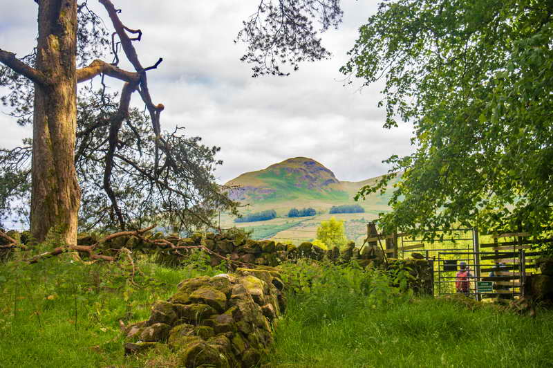
I set off on the West Highland Way at 8:42am. Just after Mugdock park you’ll see a 1,401 ft volcanic plug called Dumgoyne!! This hill is a well-known landmark visible from Glasgow. After Carbeth the views of Campsie Fells are fantastic!! I’ll never forget the first time I seen the distant Loch Lomond and Ben Lomond from here!! While walking along the track, the closer you get to Dumgoyne the better the views are. Over to the left is Kilpatrick hills and the right is Campsie Fells.
Beech Tree Inn allows hikers to eat their own lunch at the outdoor benches and you’ll see the first water tap. There’s lots of places to refill water so there was never any need to carry greater than 1½ litres of water. Some hikers prefer to use a filtered bottle at some sections but there’s many places that have free tap water.

It was fairly easy to navigate using a West Highland Way GPX and offline OS maps. The way is signposted so that really helps although sometimes the signs are not clear. One time I was walking towards Croftamie instead of Drymen and someone had pointed out I was going wrong way. I seem to recall making this exact mistake before so there should be better signposting at some bits.
The trail approaches Conic hill from the back which is a much quieter ascent. When walking for a couple of mins I seen a stunning view of Conic hill!! The only word I can think off to describe the colours is magical!! I was sunbathing for about 1 hour on the summit. It was really busy though!! I would’ve stayed longer but wanted to catch the last food orders in Balmaha.
I was really impressed with the Balmaha bunkhouse. It seemed like a B&B but the only difference was you share a room with a couple of other people. One of the guests had offered me some dinner but wanted to visit the Oak Tree Inn. I ate fish and chips and relaxed with a drink at the Inn.
Day 2: Balmaha to Inverarnan (24 miles)

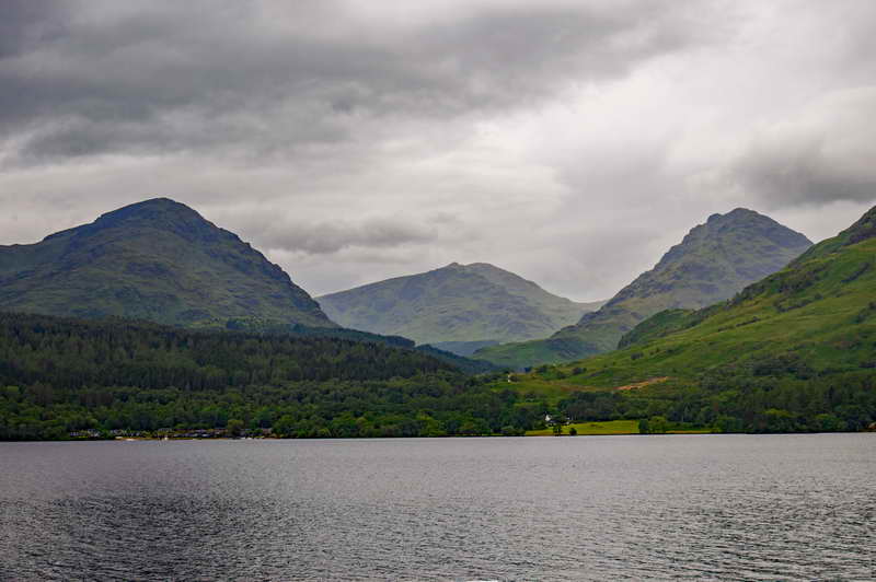
This was the day I was looking forward to the most as I never been to the end of Loch Lomond before. It started off lovely but rain was forecast from the afternoon. The section between Rowardennan and Inverarnan is one of the most scenic but also the most difficult. North of Inversnaid is supposed to be the toughest bit of the West Highland Way and has been described as hell when taking a bike. This eluded me when I biked the West Highland Way in 3 days though it was interesting to see if I could possibly take my bike through this.
The 2nd day was a relentless slog along practically the length of Loch Lomond and in rain for most of the hike. It took 8 hours just to reach Inversnaid but was concerned as I did not know how long it would take to reach Inverarnan. Fortunately, it only took another 4 hours before reaching the campsite.

It was just around sunset when arriving at the Beinglas campsite so there was just enough daylight to pitch tent without using a headlamp. I missed the last food orders so just settled for a pot noodle in the kitchen and a couple of serial bars. Prior to the trip, I bought my first portable camping stove with a couple of dinners. However, I was disappointed I never had the opportunity to use the stove. It was either too windy, too busy, dark or you weren’t allowed to use stoves in the campsite.
In the morning, I had a lovely full English breakfast. Then bought rolls, cold meat, small sachets of butter from Beinglas shop and made the rolls up in the kitchen. Therefore, saving me from having a 20 min detour walk into Crianlarich.
Day 3: Inverarnan to Bridge of Orchy (19 miles)
This was the 1st day of 3 great days of fantastic scenery I seen!! Although, I started to feel it since hiking for 12 hours the previous day must’ve worn me out. This is when I began doubting if I’d finish the West Highland Way but I soldiered on until the end. To make matters worse, blisters appeared on one of my feet. Even though I used plasters, this gradually got worse over the next couple days.

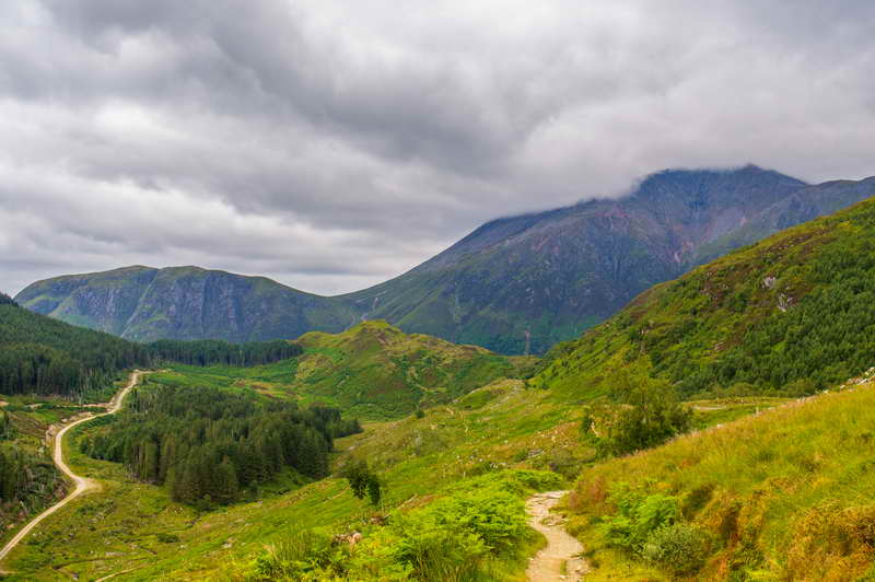
Glen Falloch is more beautiful than I thought it was!! I was in awe walking alongside rows of mountains of the Crianlarich hills. Then onto Strath Fillan where there are stunning views of Cruach Àrdrain and then Beinn Dòrain!! When reaching Tyndrum, I was exhausted and really sore. So had about an hour’s rest in the Green Welly café. The soft drinks and sandwiches are much cheaper in the garage shop than next door in the café. So bought some sandwiches for the following day’s lunch.
I nearly lost one of my walking poles when the pole fell through a gap on a bridge on day 3. Amazingly the handle prevented the pole falling into a deep river. Not sure if I would’ve finished the West Highland Way if I lost it.
I rushed to the Bridge of Orchy hotel for dinner and made my time slot by about 1 min. The burger and chips was really nice and had a couple of pints while watching the England game. I was surprised to see England getting through to the Euro 2024 final which they went on to lose against Spain. My feet were aching by this point after walking 64 miles in 3 days.

I then walked to the West Highland Way Sleeper which is a bunkhouse in a railway station on the West Highland Line. Conveniently they allow hikers to check-in 24 hours a day. I got there about 10.30pm and the bunkhouse was full of people in bed with the lights off. 3 women were still waking and started helping me since it was pitch dark. One of them was mothering me since she put my cover on the duvet. The following morning, I had breakfast at the Pantry which was great as it’s opened 24 hours a day and prices are cheap.
Day 4: Bridge of Orchy to Kinlochleven (22 miles)

In terms of scenery, this must be my best day on West Highland Way. The day started with a stunning wee walk up the summit of Mam Carraigh! The 1079ft hill is a fantastic viewpoint of Stob Ghabhar and Loch Tulla! It’s a short and easy 500ft climb from the A82.
However, it was the start to a really tough hike!! Equivalent to 2¼ Walk Highlands stages!! I was concerned that I was walking into possibly the remotest part of the West Highland Way with a couple of big blisters on one foot. Though this section was the busiest day with other hikers.
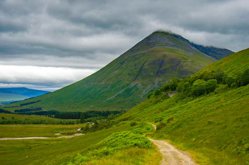
After Inveroran, you cross the desolate wilderness of Rannoch Moor along the old military road. The views of the Black Mount range are fabulous!! I’ve only been along here once before with a bike and that’s when I first seen how stunning the Black Mount are.

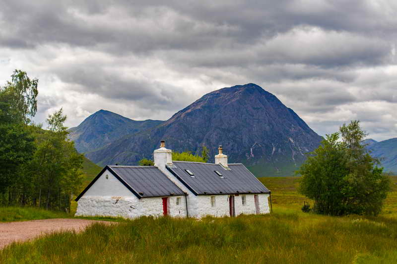
After walking alongside the Black Mount range, the trail descends into Glen Coe. This is probably the most dramatic section of the West Highland Way!! The first mountain that comes into view is Buachaille Etive Mòr, the most iconic and photographed mountain in Scotland!!
I couldn’t not stop by at the Kingshouse Hotel for a fresh orange and wee rest. Then continuing along the old military road with fantastic views of Creise and then the Buachaille!! After a long day, reached the summit of the Devil’s Staircase. Which at 1,804 feet is the highest point along the West Highland Way!!
Couldn’t stay long as I was wanting to catch the chip shop before it closed at 9pm. I knew there was a long descent into Kinlochleven though it was longer than I anticipated. The views of the Mamores mountain range are spectacular!! I missed the chippy by 15mins so bought some dinner in the Co-op and laid in my tent with a couple cans of beers. I just did not feel like going to pub as I was shattered.

Day 5: Kinlochleven to Fort William (17 miles)

Once reaching Kinlochleven, I knew that I was going to finish the West Highland Way. Last stage is the longest day for most hikers but shortest day for me.
The final stage heads to Fort William by the Lairig, which means pass. It’s a long slog around the edge of the western end of the Mamores and then into the stunningly beautiful Glen Nevis!!
Just before the end of the way, your rewarded with seeing the tallest mountain in the British Isles, Ben Nevis!! You can just tell by looking at the south face of the ben that it’s a bigger mountain than any other in Scotland!! It really is such a beautiful mountain you see on the descent into Glen Nevis!!
What I discovered on this trail is how serious blisters can be. By the time reaching Glen Nevis caravan and camping park, I was really struggling with tired legs and sore feet!! However, the West Highland Way wasn’t finished yet. There was still a 2½ miles walk into Fort William.

The caravan park was very busy with holiday makers. I pitched my tent, had a shower, applied plasters to the blisters and put on summer shoes. Then bought an expensive fish and chips takeaway though it was really big and delicious!!
I headed for the finishing line about 1 hour before sunset. Fortunately, I wasn’t struggling as the new plasters really helped. A cheerful person stopped their car and asked if I wanted a lift. I had to decline the offer as that would be cheating. When approaching the town, I thought how did I get here. Since I always drive or get bus to Fort William. Then I realised that I actually walked it from the outskirts of Glasgow.
completing The West Highland Way

I finally made it to the end of the 96-mile walk. It was a Friday night and the pubs were playing live music. So that would’ve been a nice way to celebrate but I decided to have a quiet drink in Wetherspoons!! My feet have never been as sore as this before!! I can fully relate to the “Man with Sore Feet” statue at end of West Highland Way. Implying that everyone who finishes the West Highland Way have sore feet.
There are 2 ends to the West Highland Way. There’s the original end of the West Highland Way and the official end of the West Highland Way. The latter finishes at Gordon Square in the town centre. I didn’t realise you pass 2 bronze statues while walking along the centre. I stopped at the first one and thought this was the finish. It was nearly dark so wanted to find somewhere for a drink. The pub I just happened to go to is actually on Gordon Square.

There’s also the unofficial end to the West Highland Way and that’s when hikers summit Ben Nevis the following day after completing the way. It took me over 1 week to make a full recovery. Then I returned to Fort William and climbed Ben Nevis via the Càrn Mòr Dearg Arête!! Which is the finest ascent to the summit!!
Would I walk the West Highland Way again? Absolutely, but next time I’ll hike it in 7 days.

Strava statistics
Altitude gained: 12,298ft
Distance: 102.5 miles
Time: 52 ½ hrs
5 Day Itinerary
| Day | Description | Distance | Equivalent to Walk Highlands stages | Estimated time (hrs) |
| 1 | Milngavie to Balmaha | 20 miles | 1 ½ | 8½ to 10 |
| 2 | Balmaha to Inverarnan | 21 miles | 1 ½ | 8½ to 10 |
| 3 | Inverarnan to Bridge of Orchy | 19 miles | 1 ¾ | 8 to 10 |
| 4 | Bridge of Orchy to Kinlochleven | 21 miles | 2 ¼ | 9 to 11 |
| 5 | Kinlochleven to Fort William | 15 miles | 1 | 6 to 7 |
Feel free to have a look around www.fraser-king.com to see the other fabulous pictures I’ve captured during my hiking journey. Also, please follow my Instagram account fraser.outdoors.
Some more pictures of the epic adventure

