Walking the Affric Kintail Way
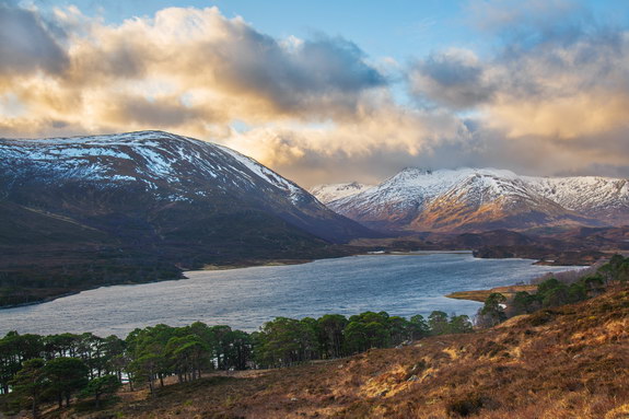
Day 1: Drumnadrochit to Cannich (15 miles)
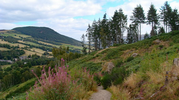
Glen Affric is often described as the most beautiful glen in Scotland, stretches for 30 miles from Kintail in the west to Cannich in Strathglass. The glen contains the third largest area of ancient Caledonian pinewoods in Scotland and much of the woodland consists of Scots pine.
This is my first long distance self-sufficient hike so was kinda out my comfort zone. I waited for a nice weather window as I wanted to practice multi-day treks without the issue of rain. The first 3 days were forecast to be warm and sunny and the 4th days forecast was rain!! The prediction was 100% correct!! Blue sky day on the 2nd day but rained all day on 4th day!
AKW starts at Drumnadrochit and then runs through forestry above Glen Urquhart. The first 2 days are through forests and these are the longest with most altitude gained for the whole way. The 1st day should not to be underestimated as this is when the rucksack is at its heaviest. A couple of times walking along narrow tracks in the forest with poor lightening in the evening. There was absolutely no one around and felt eerie!!
I chose this multi-day hike as it’s something that can be done with public transport. There’s a bus from Glasgow to Drumnadrochit and the return bus is at Shiel Bridge which is a 55 min walk from the end of the AKW. It’s worth noting that 2 sections of the road to Shiel Bridge have no pavement but there’s a path just off the road. I wasn’t sure about doing this trek as I’m lacking confidence with backpacking. Worrying about things like what would happen if the strap that holds the tent to the rucksack snaps.
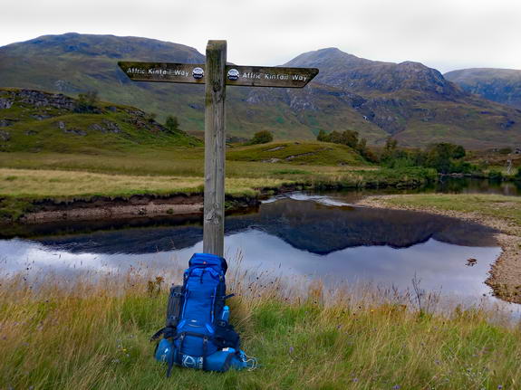
At one point the GPX route led to an A road which meant walking on the verge for over 1 mile. The verge wasn’t great for walking on and had to walk on the road sometimes so it was sketchy. I downloaded one GPX file of the whole route on some random website on the internet. If you have the choice between downloading individual day hikes on Walk Highlands then I was recommend doing this as their routes are kept up-to-date. With the Walk Highlands route, your only on the verge for about quarter of a mile.
So there weren’t many views but I was pleasantly surprised with the walk-in to Cannich. It actually turned out a really nice evening but it was tough and I ran out of water. You could see the Glen Affric mountains in the distance and felt incredible walking to these magnificent mountains in the Northwest Highlands!!
I reached Cannich just before it became dark and stayed at campsite. Cannich is the last village to stock up on things as there are no more villages until the end of the way in Morvich. Cannich has a shop, campsite, cafe, pub, restaurant and bus routes.
I lost my USB charging cable at the campsite in the pitch black and just couldn’t find it!! Thereby unable to charge my phone and use the battery pack. So there was no way to charge phone until I got home. Luckily, the shop assistant gave me a free cable at the Cannich shop. Modern mobile phone batteries can last for 2 days and longer when phone is switched off. There was not going to be any signal anyway but need phone for GPS and offline OS Maps. I learned a wee tip afterwards. Turn on airplane mode if you’re in an area with no signal to save battery.
Multi-day trekking is a different ball game than single day treks if you’re not used to carrying a full rucksack. I was sorer than I anticipated after the hike on the 1st day. One of my shoulders was so painful!! Just didn’t know if I was going to finish the AKW!! That’s 2 long distance hikes I’ve did and both times experienced pain that I’ve never had before while day hiking. Fortunately, this pain never came back again for the rest of the hike and probably just wasn’t used to carrying full rucksack.
I hiked the West Highland Way at the start of summer and the only issues I had regarding hiking and camping is I never took enough sun tan lotion and had very sore feet with blisters. Using the luggage transfer service just made everything so much easier as my suitcase had tent and loads of spare items. With this self-sufficient multi-day trek, I nearly ran out of food, ran out of water once, the phone could’ve run out of battery and most of my clothes got soaked.
Day 2: Cannich to Glen Affric (14 miles)
This was the best day in terms of weather!! It was a beautiful blue bird day!! But like the 1st day, just walking along hilly forestry tracks. Sometimes the sign posting was poor on the way especially at one point on stage 2. A small crossroad signpost was hidden at the side of the forest with a faint path leading away. I missed this and walked on the wrong side of the loch for half an hour on hilly land so was delayed by 1 hour.
After returning back to where I thought the correct route was. The GPX route was heading down the side of an inaccessible gorge!! You would probably die if you followed this route!! So had no idea how to get down to the Dog Falls carpark. Luckily, I downloaded the first 2 stages the Walk Highlands GPX route before losing the 4G signal. But you would’ve found the poorly located sign post by retracing your steps anyway.
There was still a 5 mile walk above Loch Beinn a’ Mheadhoin before the end of stage 2. I refilled water at the river next to Dog Falls which I would recommend doing. As the streams on the south side of Loch Beinn a’ Mheadhoin have a funny colour. Sometimes it’s difficult to find places to refill water on the Affric Kintail Way which means you’ll have to carry more water in rucksack. It was a relentless walk for 2 hours above the loch and only managed just over half way along the loch before finding a place to camp. This is around where the phone signal was lost and never gained a signal for another couple of days.
There was like to nowhere to camp apart from 2 flat spots with fantastic views over looking the loch. Some guy had grabbed the first one but thought my luck was in when I found a second spot. My good luck soon turned to bad luck when a large swamp of midges just happened to be there. Though I think this must be a popular place to camp and they probably live there just waiting for humans coming along.
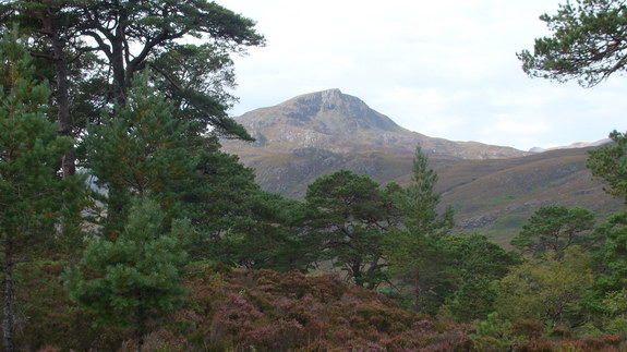
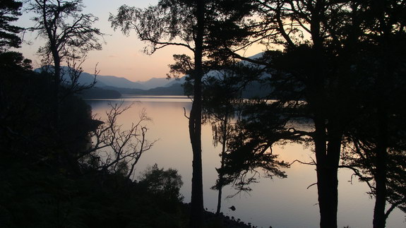
The camp spot is 800ft high and facing West where the sun was setting. It’s a fabulous view but sadly spent most of the time inside the tent!! I was planning to make a meal for the first time ever using a camping gas stove but due to inexperience, I thought the gas had run out. So settled for some cold dehydrated Pasta Bolognese. This meant that the other meals I bought for the gas stove were useless and the 3rd day was heading into the remotest part of the hike so far with limited food.
Normally I take the DLSR camera Nikon D850 or sometimes Nikon D3200 while hiking but this time just had a compact digital camera. To save from having to spend over a £100, I took a Sony DSC-H3 that I bought something like 15 years ago. It’s an 8 megapixel camera with 10X optical zoom and manual exposure mode. Apparently, there’s been no new innovations with compact digital cameras in the last few years. But maybe this camera is too old as the picture quality is poor.
I had some Vodka while relaxing after the hikes. I’m someone who never drinks spirits apart from cocktails on special occasions. Strapping a six-pack to your backpack isn’t a great idea. Vodka/whiskey weight to alcohol ratio makes this an easy choice for multi-day trips. I filled Vodka into 2 x 200ml travel bottles and double-strength diluted orange juice in a 100ml bottle. So could get approximately 16 single vodkas or 8 doubles. The 3 bottles weighed about the same as 1 can of larger.
Day 3: Glen Affric to Alltbeithe (13 miles)
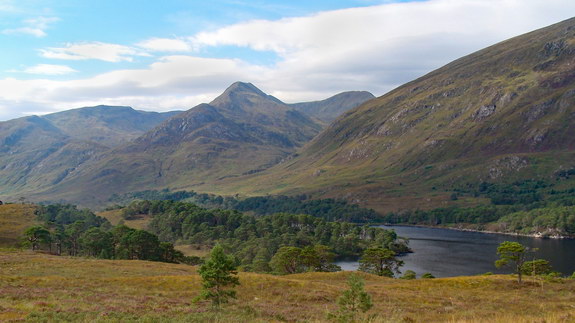
This was the easiest day and the day with the best views!! The path leads above the stunning Loch Affric while passing through magnificent pinewoods!! This is actually part of the Loch Affric circuit though you only hike the south side of the loch.
The views across the loch to the great mountains of Càrn Eige and Mam Sodhail are fantastic!! Càrn Eige is the tallest mountain in Northwest Highlands and the second-tallest mountain in the British Isles by prominence!!
Since there were issues refilling water the previous 2 days. I refilled water under the footbridge near the picnic area. Don’t recall seeing places to refill water during the first half of stage 3 but knew they’d be lots of places in the second half.
I’ve cycled along here before when hiking the Sgùrr nan Ceathreamhnan group. These are some of the remotest mountains in Britain and are miles from the nearest road!! The mountain range includes Mullach na Dheiragain which is one of the least accessible and most awkward Munros to reach!!
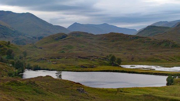
It was definitely a god send at the end of stage 3 in Alltbeithe. Thankfully in this remote wilderness there is Glen Affric Youth Hostel which is the remotest hostel in Britain!! I had good first impressions when walking in and they have a shop which sells chocolate/serial bars, sugary drinks, porridge and pouch meals.
For only £10, your allowed to use the hostel’s facilities and have permission to camp on their land. Which was a great deal considering I had camping meals I couldn’t use and was running out of food. When walking into the kitchen it was surprisingly lively with other hikers making and having dinner. The coal/wood fire was very warm and it was interesting to hear about everyone’s hikes in the area.
It was a good idea to take an iPod touch which only weighs 90g. It has a light, time/alarm, GPS, wi-fi (browser and weather app), notepad and plays music. This would save from having to use the phone’s battery. However, it would’ve been better if there was 2G signal to make and receive calls. The notepad is handy to note down mistakes and items to buy to make future multi-day hikes easier. I then store the text file on a computer, making it a useful resource for future trips.
Day 4: Alltbeithe to Morvich (11 miles)
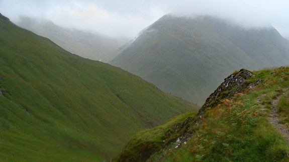
This was the toughest day with hiking through the most mountainous part of the trail and in the rain for 6 hours!! However, it was very atmospheric and probably the stage with the most dramatic scenery!! Ironically there is only 692ft altitude gained for this day which is the least out of the 4 stages. The hostel is about 870ft high up so this made it an easier starting point.
You’ll see the sheer size and beauty of the mountains of Kintail!! I couldn’t agree more when people say Kintail is one of the most beautiful places in Scotland!! The steep mountain on the right is Beinn Fhada and on the left are the Five Sisters of Kintail. The scenery is tremendous even in the rain!! The main highlight is walking along the gorge of the Allt Grannda with the impressive waterfalls!!
I stopped by at Camban bothy for a break and to shelter from the rain. Though I’ll remember this visit for the wrong reasons. The door has 2 outdoor locks that you can lock and unlock from the inside. One lock was quite stiff and I couldn’t open the door for a few mins. It was very dark at the door and my claustrophobic anxiety triggered off.
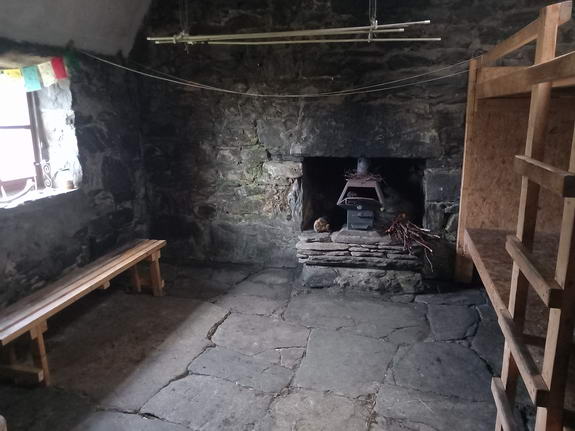
I was so glad to start descending down to the lower glen but there was still a long walk along Gleann Lichd. Just did not enjoy this part as I was rushing to catch the shop before it closed. I was very low on food but luckily everything turned out fine in regards to food.
Once reaching the end at Morvich, there’s still another 55 min walk alongside the road to the campsite. It was a miserable walk as a couple of times I was on the verge of a really busy road and still raining. When reaching the Glen Shiel campsite, it appeared the warden felt sorry for me. I’m glad it was the last day I got soaked as I was heading home the following day.
Really wanted to celebrate at the restaurant with dinner and a drink. However, it’s a 20 min walk, it was nearly dark, my boots and waterproofs were wet and I was shattered!! Some of the walk to pub is off the main road and in the middle of nowhere. Just decided to have a wee celebration resting in the tent with some Vodka.
The kettle in the campsite turned out to be a hot water boiler but I’ve never seen one before. I tried to make a pasta dinner although you need boiling water to cook pasta and the water was not hot enough. The microwave was useless as there are no containers. But figured out in the morning that you can cook instant porridge and noodles with the hot water boiler.
There’s been some obstacles I’m trying to overcome for future multi-day hikes. Why are the boots letting in water even though there only a couple months old? Why does the hiking jacket get soaked when there’s a waterproof overjacket on? How do you prevent blisters? Hopefully the first two will be solved by buying a reproofing kit to enhance the water resistance of the waterproofs and boots. To prevent blisters, I bought waterproof socks, more anti-blister socks and a lightweight microfibre travel towel specifically for drying feet. It’s important to keep your feet dry as I think this is the main cause of blisters.
Strava statistics
Altitude gained: 5,084ft
Distance: 52 miles
Time: 27 hrs
Feel free to have a look around www.fraser-king.com to see the other fabulous pictures I’ve captured during my hiking journey.
Please follow me on Instagram, on YouTube, on TikTok and Facebook.


